| Apayao - Cordillera's Last Nature Frontier |
| 2023-08-15 10:00 |
|
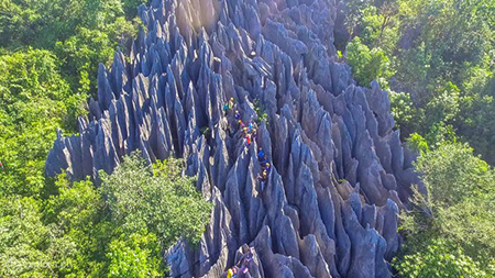
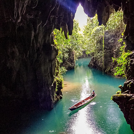
Apayao province is almost equally mountainous/hilly (Upper Apayao) and flat (Lower Apayao) with intermittent patches of valleys and plateaus. The municipalities of Calanasan, Conner and Kabugao are in Upper Apayao while the municipalities of Flora, Luna, Pudtol and Sta. Marcela are located in Lower Apayao. Its capital town is Kabugao Apayao was formerly a part of the old province of Kalinga-Apayao. However, on February 14, 1995, Republic Act No. 7878 authored by Congressman Elias K. Bulut of the lone district of Kalinga-Apayao, was passed converting the province of Kalinga-Apayao into two separate and regular provinces: Kalinga and Apayao. The province is called "Cordillera's Last Nature Frontier" because its people still maintain their peaceful coexistence with the natural environment. In Apayao, not only will you see well-preserved, rare attractions, but also locals whose age-old traditions are honored throughout the land, and respected. Quick facts Governor: BUTZY BULUT Vice Governor: REMY N. ALBANO POPULATION:124,366 (As of 2015) GEOGRAPHY: Apayao is located at the northernmost tip of the Luzon mainland. It is bounded on the east by the province of Cagayan, on the west by Ilocos Norte and Abra, and on the south by Kalinga covering an area of 4,413.35 square kilometres. CITY: 0 TOWNS/MUNICIPALITIES:7 (Calanasan, Conner, Flora, Kabugao, Luna, Pudtol and Sta. Marcela._ BARANGAYS: 133 LANGUAGE: Ilocano, Isnag (Ymandaya, Imallod, Dibagat-kabugao), Tagalog, English CLIMATE: The prevailing climate in the province falls under Corona's Type III Classification. It is characterized by not very pronounced dry and wet seasons, relatively dry from November to April and wet during the rest of the year. Heaviest rain occurs during December to February while the month of May is the warmest. |